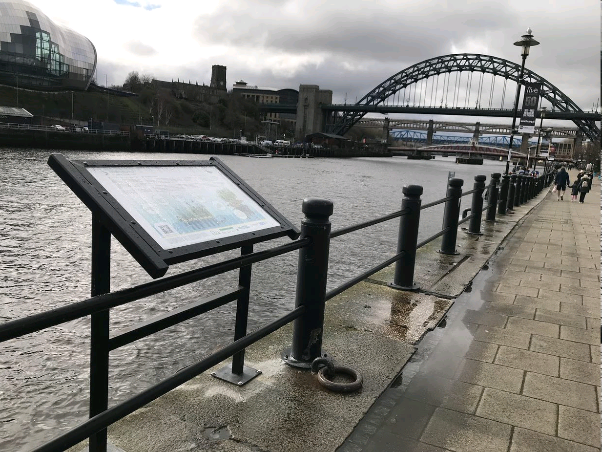
NWG work in partnership through our new approach and the scheme to identify, develop and deliver projects on an annual basis.
Click on the links to find out more about the projects included in our plan.
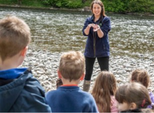
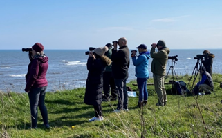
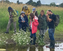
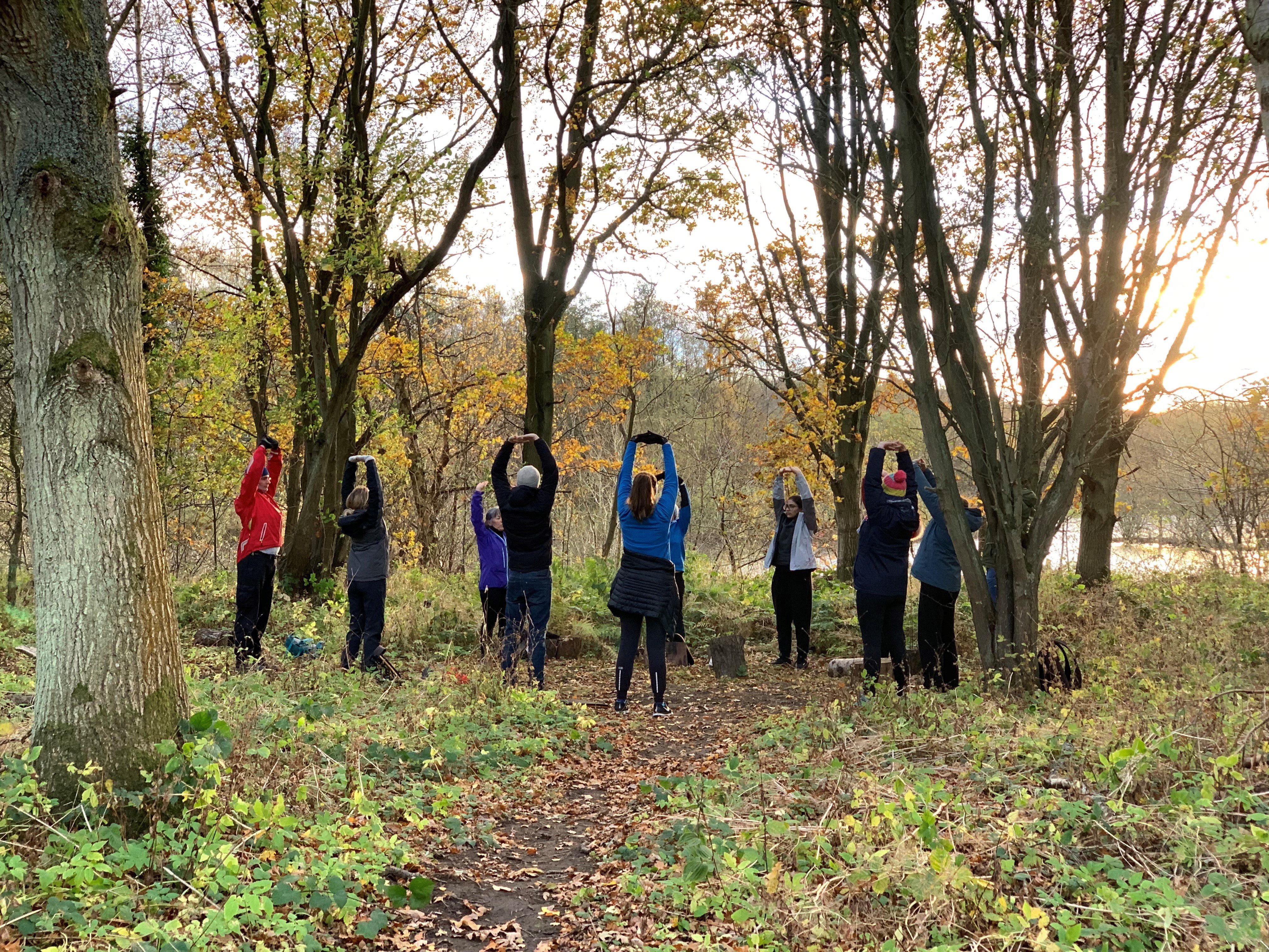
Watch these videos to find out more about our Bluespaces projects
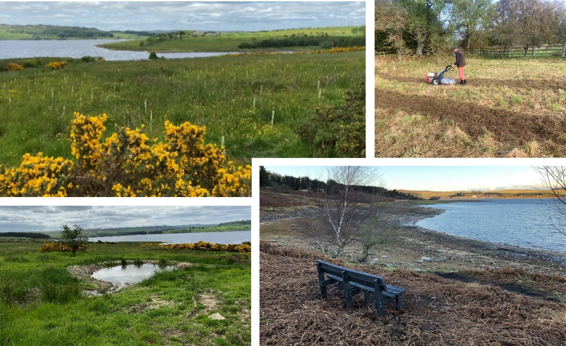
Year 5
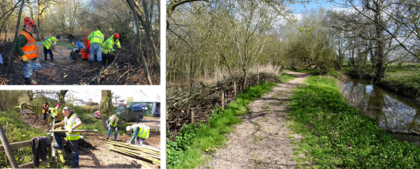
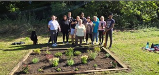
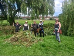
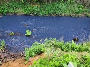
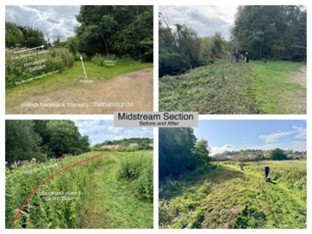
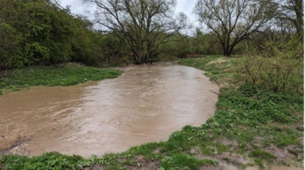
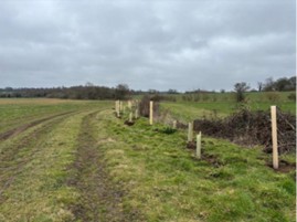
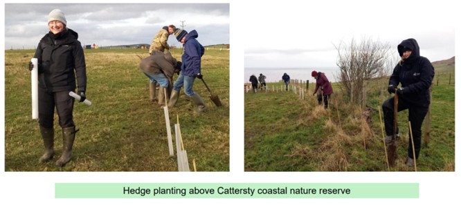
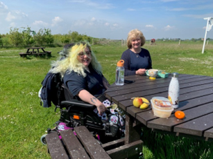
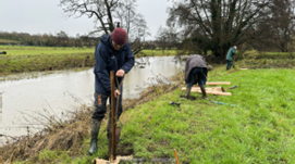
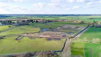
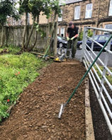
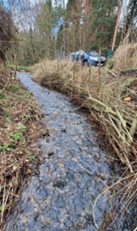
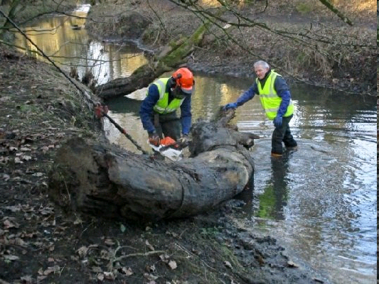
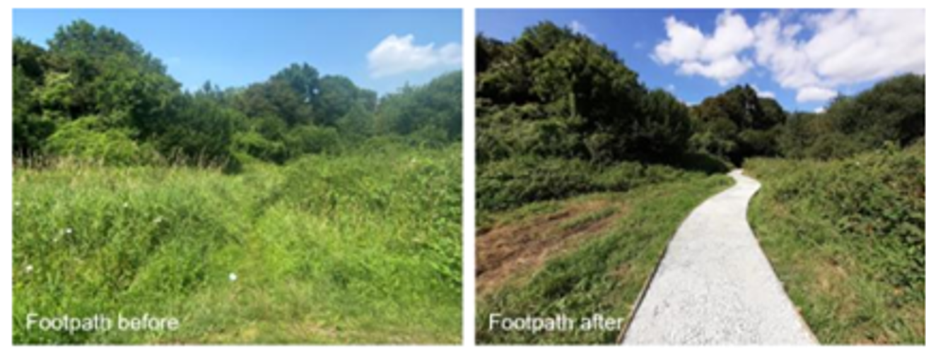
Funding from the NWG Bluespaces scheme has enabled Friends of the Denes community group and partners to achieve 4.1 km of improvements to water environments along Cocker Beck in central Darlington.
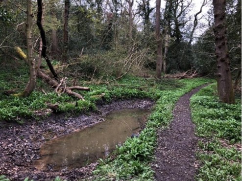
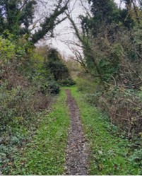
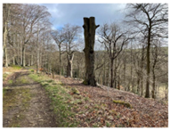
The Cocker Beck flows through 6 woodland and riverside areas, known as the Denes, in Darlington, all of which provide local water environments for customers. The surrounding urban area is densely populated, dominated by terraced housing and a lack of private gardens. Some of the area is amongst the 10% most deprived in England and so the Friends of the Denes community-led group aims to ensure the local environment is attractive, safe and welcoming for all visitors.
By working closely with Darlington Borough Council, Friends of the Denes and NWG have used Bluespaces funding to enhance the water environment in the Denes by improving recreational facilities and accessibility through footpath surface enhancements and increased seating areas. The creation of a flower bed and other wildflower planting to Padley Dene has transformed this previously negelected area of the denes into a more usable and attractive area for visitors to enjoy.
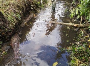
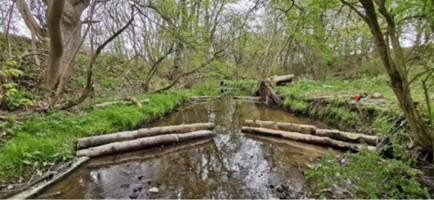
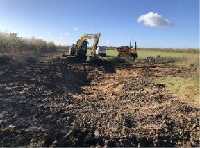
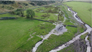
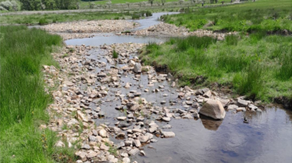
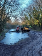
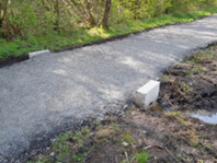
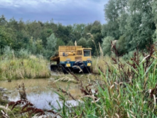
The Wear Rivers Trust and NWG have improved 2.9 km of bluespaces through the Cut Throat Dene Restoration project
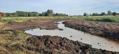
Cut Throat Dene, located on the Magnesian Limestone aquifer, marks the border between Sunderland and South Tyneside, a watershed between the Tyne and Wear operational catchments. The watercourse extends to approximately 7.5 km in length and its catchment is approximately 6 km2. This catchment was expanded in 2017 due to the connection of the drainage from the Boldon Flatts Nature Reserve, which receives input from most of Tileshed Burn, a former tributary of the River Don. The dominant land-use in the catchment is arable agriculture with several land drains emptying into Cut Throat Dene in addition to public and private outfalls and urban drains.
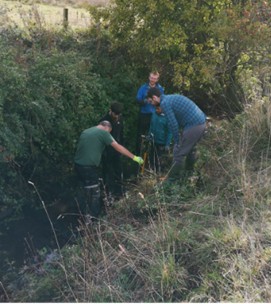
Using Bluespaces funding, the Cut Throat Dene Restoration project has delivered short term benefits to the environment and local communities and has allowed Wear Rivers Trust to investigate suspected pollution sources and to identify remediation options to eliminate pollution sources and pathways. Further long-term improvements to the local environment and community would be delivered in the second phase of this work, should it be funded by Bluespaces and other partners. In this long-term vision, an attractive green corridor linking the coast at Seaburn with Fullwell Quarry Nature Reserve and Whitburn Moor and Boldon Flatts would be created.
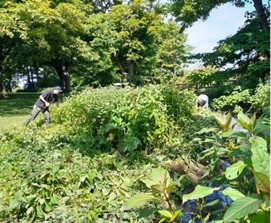
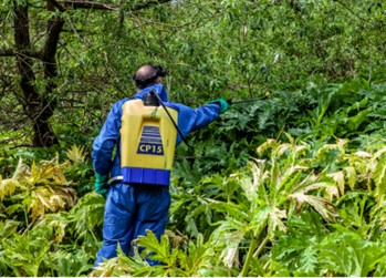
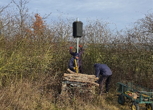
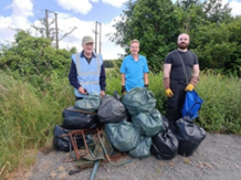
This project has allowed Wear Rivers Trust and Sunderland City Council to engage with local individuals, community groups and local Sunderland and South Tyneside schools to publicise the potential of Cut Throat Dene as a ‘green lung’ for the area. By using the water environment as an educational resource, it has helped to raise awareness of the connectivity and the importance of controlling terrestrial, river and marine pollution. Volunteering events held were focused on stream litter clearances, and Himalayan Balsam control.
Through the Cut Throat Dene Restoration project, litter pollution has been removed from the eastern half of the project area and a complete removal of Himalayan Balsam identified at the source location has been carried out. Prior to this project’s inception, Sunderland City Council had plans to create a new play park on the lower reaches of the watercourse. Wear Rivers Trust advised Sunderland City Council on appropriate bank protection as the play park works involved removing the steep concrete walls that contained the watercourse upstream of the beach outfall. Pollution sources and invasive non-native species within the dene have been mapped and plans have been developed for further water environment improvements, encompassing access, biodiversity and water quality outcomes.
Funding from the NWG Bluespacs scheme has enabled Tweed Forum and partners to achieve 3.6 km of improvements to water environments along the River Tweed in north Northumberland at Norham and Berwick.
The main vision beyond this project was to create a 182 km trail from Moffat to the source of the Tweed and on to Berwick, where the river meets the sea, by 2027. This Bluespaces project forms part of the five-year multi-partner project, led by Tweed forum, that commenced in 2022 and comprises 13 projects focusing on Environment, Community and Economy. Along the section of the River Tweed that runs through north Northumberland, there is a potential of 30.5 km of bluespace improvements that could be delivered by the end of these five years. Through this Bluespaces project, activity was focused on three of the 13 projects: Tweed WATCH Education Programme, Connecting Threads Cultural Programme and Pollinators Along the Tweed habitat creation.
Bluespaces funding supported the delivery of 7 education events across Berwickshire, 23 cultural public engagement events raising environmental awareness and creation of 0.3 ha of pollinator-friendly meadow management. Digital interpretation material was also created with a Destination Tweed website in place, a regular newsletter, animated film and a dedicated growing social media following. The collection of Destination Tweed projects in the area of focus for NWG have already benefitted rural communities by providing these volunteer and engagement opportunities.
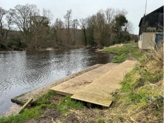
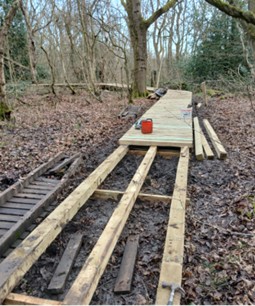
The National Trust and NWG have improved 1 km of bluespaces at Ebchester West Wood and Ebchester Boathouse alongside the River Derwent in County Durham.
The site along the River Derwent is very narrow and the footpath runs along a steep cross-slope that has suffered from runoff and erosion, negatively impacting the wildlife and woodland habitats and visitor enjoyment. Recreational use of the river has increased significantly, making access to the landing stage along the riverbank muddy, slippery and dangerous due to increased usage for launching canoes and kayaks.
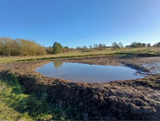
This Bluespaces project has delivered interventions to the woodland area and provided a board walk and jetty along riverbank to provide safe access along the river and enhance user’s enjoyment of the water environment. The Bluespaces improvements delivered through this project have created an improved water environment that customers can access safely while also delivering key wildlife and biodiversity benefits, including creation of a pond at the southern end of the woodland to provide new habitats and drainage.
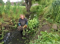
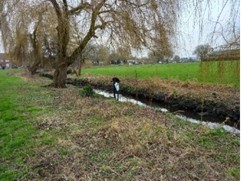
Bluespaces funding has supported delivery of a project to improve 2.5 km of water environment at Gores Brook, a stream in the Roding, Beam and Ingrebourne catchment that flows through Dagenham in East London.
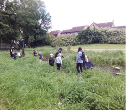
Working with partners, Thames21 and NWG have delivered improvements with Bluespaces funding, including community action days clearing litter, invasive Himalayan Balsam and other dominant vegetation and the planting of native marginal plug plants and wildflower seeds.
Over a series of 10 events, both members of the public and volunteers were engaged, all contributing to the improved access of Gores Brook and the consequential reduction in anti-social behavior. The Himalayan Balsam removal and native plug planting has improved the quality and views of the Gores Brook.
The installation of a real-time water quality sensor after the completion of this project will be maintained by volunteers and will collect accurate data used to support wider ambitions to de-culvert and further restore the water environment through Goresbrook Park.
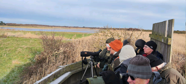
Northumbrian Water funding has supported the delivery of improvements to 2.4 km of water environment at Hauxley nature reserve surrounding the Druridge Pools along Druridge Bay in Northumberland.
The Hauxley is a 20 ha nature reserve owned by Northumberland Wildlife Trust, supporting a series of wetland and woodland habitats. It serves as a prominent gateway for approximately 50,000 visitors exploring the reserves along Druridge Bay and beyond. The site hists a Wildlife Discovery Centre with toilet facilities, café, shop and outdoor play area. There are also a variety of nature trails and bird hides for visitors to use.
This project has enhanced the accessibility, visitor experience and habitats along the site to improve these bluespaces for public enjoyment. This was achieved trough the creation of a new bird hide offering exceptional views over wetland habitat, tree planting, installation of a new brass rubbing trail along the accessible paths and drainage improvements to improve the accessibility of the circular footpath route.
Bluespaces funding has supported the delivery of a new Ponteland bird hide made accessible and safe to use for visitors, the planting if approximately 300 trees to enhance the shelter belt and provide new habitat for bird species and the creation of extra wetland features on-site linked to drainage improvements.
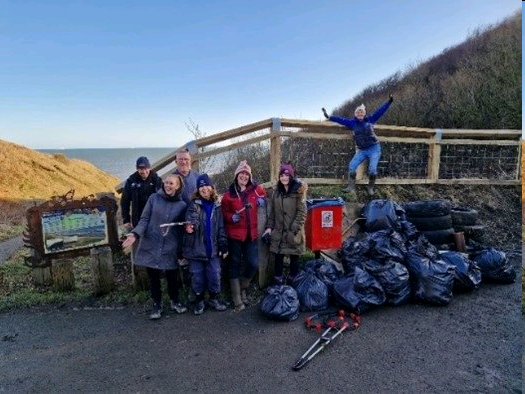
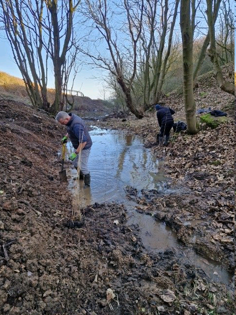
Bluespaces funding has supported delivery of a project to improve 0.5 km of water environment at Hazel Dene along Durham Coast in Seaham, County Durham.
Hazel Dene is situated on the Durham Coast and is a key bluespace for the residents of Seaham and Dawdon. The site consists of a small, wooded dene with a seasonal stream running down through several culverts to Chemcial Beach near the popular Nose’s Point Car park. The site suffers from littering and fly tipping from nearby allotments, which poses a threat to the local wildlife and creates a neglected environment. The surrounding grassland and glade habitats throughout the site are also in need of conservation management.
Durham County Council, through the SeaScapes Landscape Partnership, have used Bluespaces funding to restore this previously unused and undervalued area of bluespaces near the Durham coast. This project is also linked to the overarching SeaScapes Heritage Lottery Funded programme for which NWG has been a co-funder and deliverer of the BeachCare and Aware project. The success of this Bluespaces project stems largely from the community engagement with the site, particularly young people taking ownership of the natural environment around them. The site has since benefitted from reduced anti-social behaviour and litter in addition to increased public use.
Over 12 volunteering events were held from the large events programme engaging the local community with the site, supported by SeaScapes, and the Princes Trust programme linked to the site, engaging young people and increasing their skills. Further improvements to this site include new seating and interpretation to provide facilities and increase local use of the area and creation of an ecological management plan to support future plans and build on the work of this project.
Funding from the NWG Bluespaces scheme has enabled the Wear Rivers Trust and partners to achieve 6.7 km of improvements to water environments.
The Hummer Beck catchment is one of the most intensively farmed areas within the Wear and there is some evidence of over-grazing and lack of bankside management. Fencing is limited or in poor condition. Fly-tipping and agricultural pollution/weak land management is also recorded throughout the catchment area.
This Bluespaces project has built on a previous NWG water quality improvement badeline, delivered through WINEP to remove phosphorous from final effluent discharged from New Moors sewage treatment works.
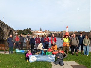
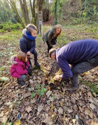
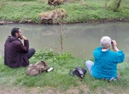
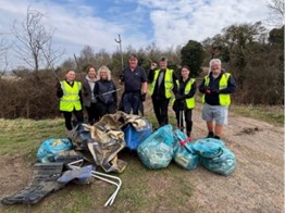
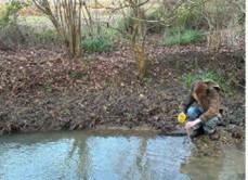
Educational activities have been delivered in the project area, engaging volunteers through liter picking events and utilising existing community networks to attract additional volunteers to deliver the habitat tasks through farmer engagement and to clear rubbish from the watercourse. Access links have been improved with refreshed waymarking and INNS surveys have improved catchment records as well as Riverfly surveys that have contributed to monitoring of water quality and fish populations. This community group, the Gaunless Guardians, now conducts regular water quality testing and reports any issues to NWG and EA. Water quality has been further improved by removing rubbish from within and adjacent to the watercourse.
Through this project, Durham Wildlife Trust has worked with NWG to deliver access, wildlife and water quality improvements across the Sunderland Coalfields in Tyne and Waer, improving 9.7 km of water environment.
This Bluespaces project covers the 13 council-owned sites in the Sunderland Coalfields, Sunderland’s southern urban fringe.
Bluespaces funding has contributed towards revenue costs in the first year of this project, delivering significant environmental improvements. These include habitat improvements, such as woodland and grassland management, across 11 of the identified green and bluespaces in the Sunderland Coalfield. In addition, 2300 trees and almost 1 km of hedgerow have been planted. Access improvements have also been delivered through 4.3 km of paths created or upgraded and 120 m of boardwalk built. Water quality improvements, such as the creation of wetland scrapes and community clean up events, have improved the state and appearance of the watercourse and enhanced visitor enjoyment of the area. Local engagement has also resulted in traineeships supporting professional development and accredited training in land management skills for two conservation trainees, benefitting health and wellbeing and influencing positive environmental behaviours.
Funding from the NWG Bluespaces scheme has enabled the Northumberland Rivers Trust and partners to achieve 4.3 km of improvements to water environments within the Longdike Burn catchment upstream from the Northumberland Zoo and further downstream at Longhorsley Moor.
This project had the opportunity to enhance engagement with the local water environment for residents of Longhorsley, the surrounding villages and visitors to the zoo to increase enjoyment along a Northumberland stream.
This Bluespaces project has delivered and will continue to deliver benefits for residents and visitors to Longhorsley and the surrounding villages by offering the opportunity to engage with the Northumberland stream and for visitors to Northumberland Zoo to interact with the local water environment as part of their day out. The creation of new wetlands across 0.28 ha will help filter nutrietns and retail runoff as well as pollutants from neighbouring land. Several field drains have also been intercepted during construction, which has also reduced potential point source pollution, improving the river’s water quality.
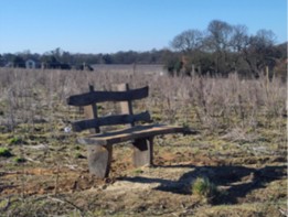
Suffolk Wildlife Trust and NWG have improved 6.9 km of bluespaces through the Martlesham Wilds Bluespaces project, creating a new 117-hectare nature reserve beside the River Deben at Martlesham.
This project has delivered several benefits for wildlife, such as black poplar planting, hedge laying, bat and bird boxes in addition to several engagement and species monitoring events. Although unforeseen timescales required for site planning permission limited the delivery of the expected wildlife outcomes of saltmarsh incursion and vertebrate bunds, these alternative improvements have provided additional benefits for the abundance of species present.
Public enjoyment has also been enhanced through the transformation of a large area of former arable land adjacent to the river and estuary into a nature reserve. This new nature reserve has benefited wildlife and helped address run-off issues that impacted the water quality. With Bluespaces funding, Martlesham Wilds has also delivered pond restorations, wildlife viewing platforms, interpretation boards and a locally crafted bench, which have improved access and enjoyment of this water environment.
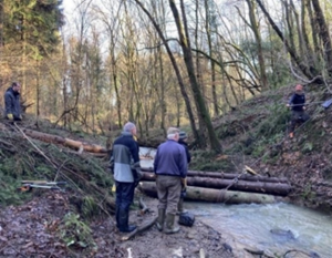
Bluespaces funding has supported delivery of a multi-partner project to improve 7.8 km of water environment at Old Durham Beck in the Wear Management Catchment, County Durham.
The Old Durham Beck is thought to be the highest-known source of Giant Hogweed on the River Wear and so addressing the issue here has complemented efforts to eradicate the species from elsewhere throughout the catchment.
The focus of this project has been restoration activities to enhance biodiversity and help river and habitat recovery, including mapping and treating Giant Hogweed along the catchment. Bluespaces funding has helped to support this through a team of two Project Officers and one Volunteer Coordinator. In addition to INNS control, engagement of volunteers with litter picking has improved the instream habitat. In the upper catchment, 12 pairs of instream flow deflectors were installed, benefitting the Coalford Beck by slowing water flow and providing resilience.
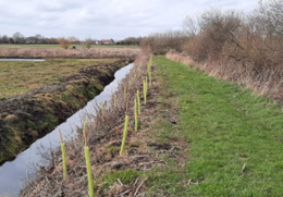
The rate of surface water run-off from the pasture has also been reduced through the creation of an ungrazed riparian corridor that has been planted with native trees to provide shade and increased leaf litter input.
With Bluespaces Funding, the River Gipping Trust has improved 10.8 km of accessible water environments between Ipswich and Stowmarket along the River Gipping.
This project has enhanced access along the River Gipping through the Himalayan Balsam control, bench installation, social media engagement and the dedication of 12 River Gipping Trust volunteers since 2024. Views of the river have been increased and improved through the Himalayan Balsam control and reshaped the overgrown path into an open space where the water environment can be enjoyed.
Additional access improvements to this bluespace include the installation of three benches and four interpretation boards. There has been strong local engagement with this project, reaching over 27700 people through social media.
A management plan created by The River Gipping Trust overseeing the next two years will maintain the Himalayan Balsam control. This plan includes continued management of current areas improved through the Bluespaces funding by Trust volunteers and a series of volunteer days in partnership with National Highways and Stowmarket Volunteers.
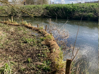
Through this project, Durham Wildlife Trust and partners have worked with NWG to deliver access, wildlife and water quality improvements along the River Skerne, improving 3.6 km of water environment.
The River Skerne runs between the village of Fishburn and Hardwick Country Park, following the course of a former railway, which is used as access for locals and visitors. This bluespaces project built on a NWG water quality improvement baseline, delivered through WINEP investment, to install permanent infrastructure to remove phosphorous from final effluent discharged from Fishburn sewage treatment works flowing into the Skerne. The water quality improvements delivered through this project has resulted in improvement towards ‘Good’ status.
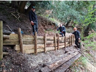
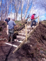
Through the Skerne Bridleway and River Restoration project, access has been improved and dedicated as a Public Bridleway, building on the restoration of the Holdforth Railway Bridge in 2020/21, which reconnects access between local communities. One section of the bridleway has been resurfaced, and new gates, drainage and signage have been installed to create a safe and engaging route along the River Skerne corridor.
Significant improvements to the riverside access have created a safe route along the river and the installation of in-stream deflectors, woody debris and bank protection have improved the water quality and biodiversity value of the riparian habitat. The tree thinning and tree-planting elsewhere along the riverside have also created a greater diversity of habitat for wildlife and willow clearance from a pond has restored open-water habitat for the benefit of great-crested newts and other aquatic wildlife.
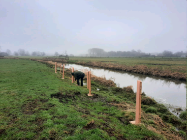
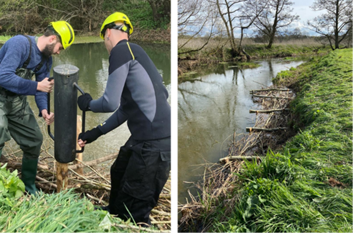
The Wear Rivers Trust, with Northumbrian Water and other partners, has delivered 3.2 km of water environment improvements through this bluespaces restoration project in the South Burn catchment.
The South Burn catchment is on the urban fringe between the urban areas of Chester-Le-Street to the North and Durham to the South. It contains residential housing, predominantly arable farmland and high-quality natural environments, including the wooded riparian corridor Daisy Hill Local Nature Reserve and Waldridge Fell. This well-frequented area provides important access to nature for residents and visitors.
The water quality improvements delivered in March 2025 have resulted in improvements towards ‘Good’ status for South Burn. Further water environment improvements have been delivered throughout the length of the South Burn from source to the River Wear confluence. The identification and remediation of pollution sources entering the watercourse, INNS mapping and removal of Typha from ponds has also contributed to the improvements in water quality.
Green engineering bankside intervention have improved access through erosion mitigation on a footpath bridge within Daisy Hill Nature Reserve, reducing sediment run-off and preventing deterioration of footpath access. Step repairs and dead hedging has also improved safe access to public rights of way.
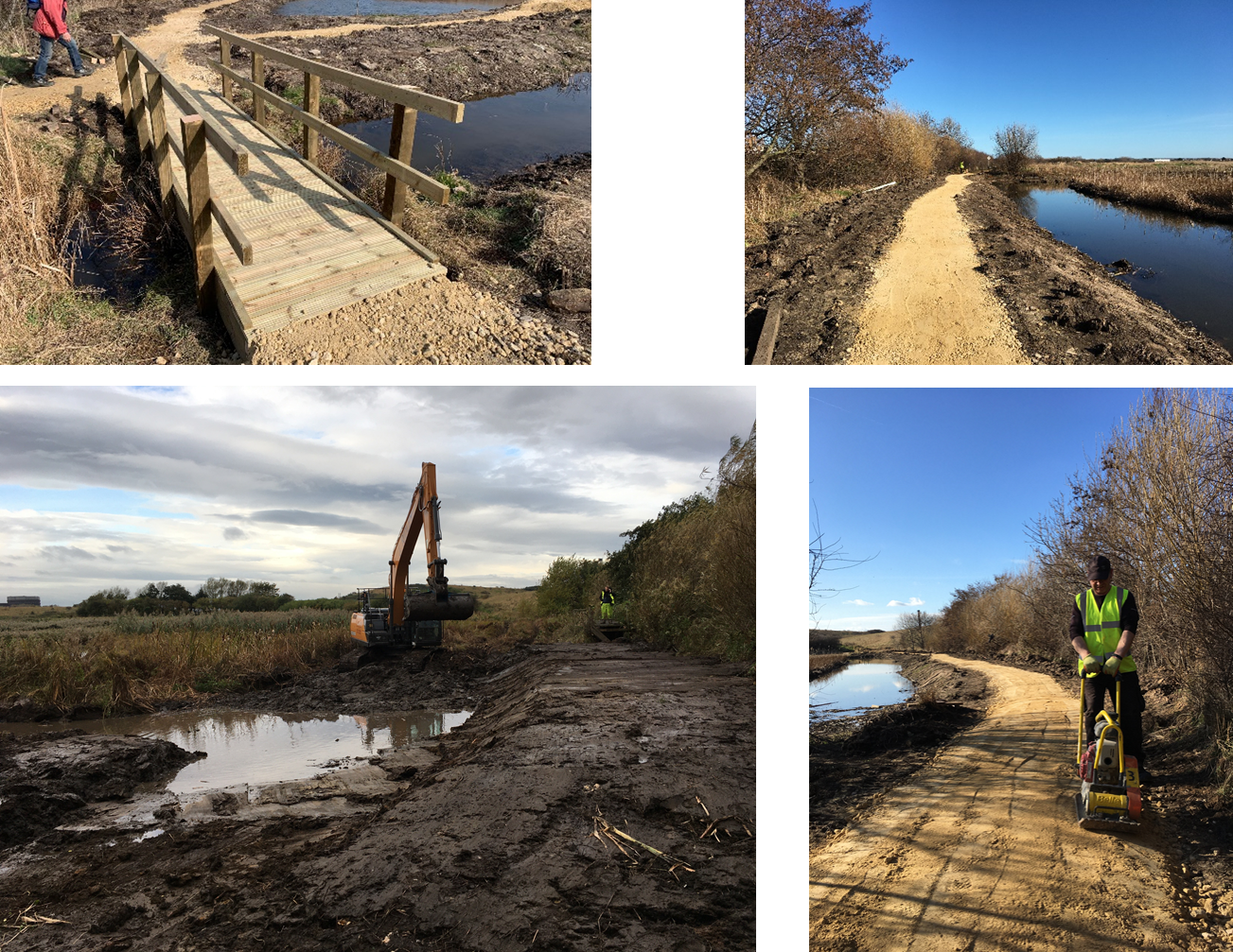
Northumbrian Water funding has supported delivery improvements to 13.5 km of water environment across eight sites within Stockton-on-Tees, County Durham.
This Bluespaces project has delivered biodiversity improvements to both aquatic and surrounding terrestrial habitats and supported education and citizen science provision for the benefit of NWG’s customers. This project has worked across eight sites within Stockton-on-Tees, including Billingham Beck Valley Country Park, Elmtree Beck, Greens Beck and Grangefield Park.
Over 1.8 km of footpath have been improved, enhancing public access to the site, and 380 tonnes of gravel have been used to enhance riparian habitata and diversify instream water flows. Over 4000 native trees have also been planted, creating 700 m of hedging. The Weir in Billingham Beck has also been removed, enabling free passage of fish and tidal interchange for the first time in over 300 years, which has allowed for increased movement and distribution of species up the watercourse.
The River Waveney Trust has used Bluespaces funding to work with partners to deliver 2.4 km of water improvements along the Tin River.
The Tin River, a tributary to the River Waveney in Bungay, derives its name from the corrugated sheet lining that was installed on the riverbed post-World War II. These metal sheets disconnected the river from its bed, resulting in a loss of habitat for aquatic plants and invertebrates and preventing groundwater infiltration. In conditions of heavy rainfall, the river had fast flows and heavy sediment run-off and during the summer months the river had little to no water in the upper reaches.
The Tin River Restoration and Flood Management Project has created a 3D water buffer of trees and shrubs along the river, enhancing the quality of the river for wildlife, reducing diffuse pollutants from entering the river and helping to create greater natural beauty along the river for footpath users. Access improvements, including the installation of interpretation boards have helped the public engage with the Tin River water environment.
Improvements delivered to the Tin River have had a positive impact on water quality and flood risk in the Waveney Valley downstream of Tin River, benefiting both the local community and the wildlife.
Bluespaces funding has supported delivery of a project to improve 7.2 km of water environment at Upper Roding Trout, a stretch of the River Roding that largely flows through an agricultural area of East Essex before reaching London.
Along the northern extent of the Roding, trout spawning grounds have been discovered and adult fish have been located at the southern end. Areas along the River Roding are neglected, hosting an overgrown, silted river which reduces the availability of trout habitat and impedes access to and views of the river.
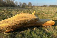
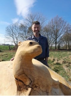
The Upper Roding Trout Project has enhanced access to the River Roding through the installation of benches, one of which was made by a local woodcarver. Interpretation boards also encourage a walking route through the farmers’ land and highlight volunteering opportunities.
The Bluespaces funding has also delivered improvements to wildlife, biodiversity and water quality through the installation of bird and bat boxes, a new reedbed, a watercourse buffer habitat, water quality testing and trout habitat creation.
Durham County Council and partners have improved 17.5 km of bluespaces across both Castle Eden Dene and Teesmouth National Nature Reserves through the delivery of activities by the creation of a Water and Wellbeing Warden post.
Working across both Castle Eden Dene and Teesmouth National Nature Reserves, a new ‘Water and Wellbeing Warden’ post will complement and build on existing work with partners. Both sites have many areas of bluespaces, including coastal streams, ponds, mudflat, rivers, estuary and the sea. This post will ensure that the local environment, site facilities and engagement events offer a safe and positive welcome for visitors, whilst encouraging responsible use of these two important nature sites on the North East coast for people and wildlife.
This warden post is working as part of the wider Natural England site management team, complementing and building on existing partnership working. A wealth of visitor engagement activities are being delivered in addition to promoting visitor learning, carrying out surveys and wildlife monitoring. These activities have provided a great visitor experience for NWG customers and other visitors accessing these bluespaces on the North East coast. There have also been physical improvements to access, interpretation and signage.
This project highlights the partnership working that has raised the profile of both reserves amongst the local community and attracted new visitors to the sites.
The Tees Valley Wildlife Trust has used Bluespaces funding to work with partners to deliver 7.7 km of water environment improvements along the Tees Coast.
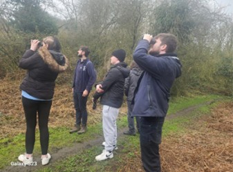
Wilder Coast activity has been continued on from the 2021-22 phase to July 2024 through activities led by a designated Wilder Coast Project Officer. The appointment of this dedicated project officer has enabled delivery of water environment improvements, such as sea level rise and soft sea defences. Over 117 volunteers, including community groups and coastal citizen scientists have become involved with the project, involving education and encouragement of positive environmental behaviours within local communities.
Access improvements and new interpretation boards at the eastern end of the Wilder Coast project area have been installed to improve visitor experience of the site. This project has also contributed to national datasets by providing the findings of project surveys.
Year 4
Through this Bluespaces project, Essex Wildlife Trust (EWT), Essex & Suffolk Water (NWG) and partners have improved 3.9 km of water environment at Abberton Reservoir.
Abberton Reservoir, owned by NWG, is internationally important for wildfowl and designated as a SSSI, SPA and Ramsar Site. EWT manages part of the site around the Abberton Reservoir Nature Discovery Centre as a nature reserve, which is one of the most popular reserves in Essex. Partners have worked since 2022 to deliver substantial visitor experience improvements and benefits to wildlife and biodiversity, which go above and beyond NWG’s statutory responsibilities to provide and maintain access to the site.
Bluespaces funding has supported delivery of a project to improve 2.3 km of water environment at Allen Banks, a public access National Trust site on the banks of the River Allen in the Tyne Catchment, Northumberland.
Allen Banks and Staward Gorge is the largest ancient semi-natural woodland in Northumberland. Lying in the gorge of the river Allen, it receives approximately 50,000 visitors/year. The site is cared for by the National Trust, with the aim of maintaining and enhancing visitor access, biodiversity and cultural heritage. This project has delivered bluespaces improvements which contribute to all three of these aims.
The project has made significant access improvements along a section of riverside path. New boardwalks, steps, revetment, resurfacing and trip hazard removal will mean that more people can access the riverwalk more easily year-round. Through volunteer days, people have been able to get involved in delivering access improvements, invasive species control and tree planting, giving them opportunity to socialise and keep fit in the outdoors while having a positive impact on the environment.
Installation of deer fencing is the woodland is enabling natural regeneration where dangerous trees which had previously shaded the ground needed to be monolithed. The historic beech avenue which had lost several trees to storms, age and disease has also been enhanced through the planting of replacement trees, which will not only keep the avenue in existence into the future, but also protect it from climate change and pest and disease by diversifying the species mix within it.
Himalayan balsam control has benefited the wider water environment by preventing the further spread of seed in the local area and downstream.
Bluespaces funding has supported delivery of a multi-partner project to improve 2.2 km of water environment along the Angles Way, impacting a stretch of the River Waveney from Brockdish to Needham.
This project is part of the larger ‘River Access for All’ scheme and is a follow-on from the Year 2 Bluespaces project River Waveney Access and Biodiversity Project which improved 6.8 km of other water environment, and identified several specific improvements to be delivered in this area (the 2.2 km improved in this project were not claimed in the previous project). Project partners include the River Waveney Trust, Anglian Water, Norfolk County Council, Canoe Foundation, Paul Bassam Trust, Geoffrey Burton Trust, Needham Parish Council, and Pathmakers.
The Angles Way project has enhanced access along and next to the river (including providing an additional 0.8 km of temporary access), and improved habitats through strong working relationships driving activity across project partners, landowners, the Environment Agency and volunteers from the local community. As part of this project a number of key water environment improvements along this stretch have been delivered, and further actions have also been identified for 2024.
The SeaScapes Landscape Partnership, Heritage Coast Partnership and NWG have improved 3.3 km of bluespaces through Caring for Crimdon Dene.
This is the fourth project to be delivered linked to the SeaScapes programme, in which NWG is a partner investing £370K in the Beach Care and Aware project and the Beach Care Officer role to support coastal environment activities across the Tyne-Tees area from 2021-2025.
Crimdon Dene is located between Blackhall Rocks and Hartlepool on the A1086 Durham coast road. Crimdon Beck runs through Crimdon Dene and discharges into the sea near Crimdon. The stream flows directly on to Crimdon beach, an important breeding ground for the Little Tern, one of Britain's rarest sea birds, as well as providing coastal habitat for other birds including Ringed Plover and Oyster Catchers. The Dene comprises steep sided woodland and is a designated local nature reserve. This project forms part of a wider SeaScapes/Heritage Coast partnership scheme to improve access and interpretation along Crimdon promenade and from the Dunes café.
Through this Bluespaces project, community awareness of the local water environment, and access and habitats around Crimdon Dene have all been improved. Installation of new seating and work to clear and protect pathways has made the site more accessible, and the removal of litter has made the Dene much more appealing to visit. Public events have engaged the local community and visitors with the Dene, promoting it as an attractive option for local recreation alongside the coastal beaches.
The Otter Trust has used Bluespaces funding to work with partners to deliver 4.1 km of water environment improvements at Dickleburgh Moor, in the upper Waveney Valley, near Diss, Norfolk.
Dickleburgh Moor is a Nature Reserve owned by The Otter Trust, which has recently increased in size. It is located is on the site of an ancient glacial lake and contains a considerable peat deposit (in places over 35m deep). An Internal Drainage Board ditch borders the site along the southern boundary, with excess water being pumped from Dickleburgh Moor and into the ditch to flow towards the River Waveney. Decades of poor agricultural management and inappropriate land drainage leading to excessive summer drying and extreme winter flooding had reduced the biodiversity of the site. In March 2023 under planning law, land use was officially changed from agriculture to Nature Reserve, and the site is now being restored and managed for wildlife. This archaeological site was home to early Britons and contains archaeological sites of interest.
This Bluespaces project has restored the aquatic habitats at Dickleburgh Moor, created new and enhanced habitats, increased flood storage across the site, and improved and increased public access to the Nature Reserve for the local community.
Going forward, The Otter Trust has purchased further land on the eastern side of Dickleburgh Moor. During the winter of 2024/25 the trust intends to turn these arable fields into wet meadows and hopes to deliver further improvements to water quality and public access.
Embleton Parish Council and NWG have improved 1.4 km of bluespaces at Embleton Quarry Nature Reserve, near Embleton on the Northumberland coast.
The project has helped create a better visitor experience to this local water environment, through improved access, better interpretation, and enhanced biodiversity. Highlights include footpath improvements, new signage, installation of bat roosts, creation of a sand martin bank, and community engagement activities.

Northumbrian Water funding has supported delivery improvements to 0.9 km of water environment at Haltwhistle Riverside Park in West End, Haltwhistle, Northumberland.
The park is an area of reclaimed railway yard to the south of Haltwhistle railway station and is bordered by the River South Tyne. It includes the old railway of the Alston branch line. The area of the former old railway yard is covered almost exclusively by Silver Birch, whilst the riverside has greater diversity of flora but is a much smaller area. There are two water outlets in the park which form a small stream.
The Haltwhistle Riverside Park project, led by South Tynedale Railway volunteers, is endeavouring to develop the neglected railway yard and adjacent riverbank into a valued public amenity and wildlife park, introducing trees and new habitat to encourage more animals and birds into the area.
Improvements delivered have transformed the area for the local community, with a plan of more work to do in the future led by volunteers.
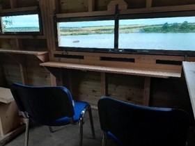
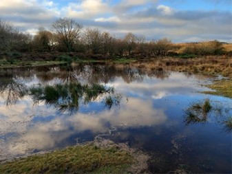
The RSPB, with Northumbrian Water and other partners, has delivered 2 km of water environment improvements through this large-scale wetland restoration project at RSPB Geltsdale in the upper Tyne catchment.
Howgill Beck is situated on RSPB Geltsdale and is within the Geltsdale & Glendue Fells SSSI, the North Pennine Moors SAC & SPA and is part of the North Pennines AONB.
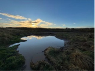
Howgill Beck has been re-meandered to provide a flood meadow, allowing the beck to form its own natural course and create a delta into the Tindale Tarn downstream. This has restored wetland habitats that have been lost after historical watercourse modification to drain the surrounding meadow to aid livestock grazing. The more sinuous route results in a river with a greater diversity of width, depth, and flow rate, which will create a greater range of conditions within the river, delivering benefits for biodiversity, raw water quality, flood alleviation and public enjoyment by reinstating natural processes.
The restoration work has taken place adjacent to the RSBP’s Stagsike Cottage visitor centre and is in the vicinity of multiple promoted visitor trails in one of the most accessible areas of this upland reserve, so it is clearly visible from different vantage points and paths on site.
The area has been transformed from dry species-poor grassland into a bustling wetland habitat. The wildlife spectacle has been enhanced as a result, and the education and demonstration of the site improvements and its benefits to visitors and other land managers and decision makers has been an important aspect of the project.
Through this project, North Tyneside Council has worked with NWG to deliver access and recreation improvements throughout Marden Quarry Local Nature Reserve improving 1 km of water environment.
Marden Quarry is an important area of green and blue space located in a highly urban area, Near Whitley Bay, North Tyneside, and is popular with the local community for walking and recreation. A variety of wildlife has been recorded using the freshwater lake habitat which dominates the reserve, and areas of broadleaf woodland and scrub also support woodland birds and roosting bats. Previously, the access around the site was poor, particularly as the area suffers from seasonal flooding which made some paths unusable, and there were also limited recreational facilities. The lake outfall discharges to the coast at Cullercoats, so improving the outfall and reducing litter and pollutants into and from the lake is also to be a wider benefit of improvements delivered through this project.
The well-used path around the lakeside is subject to seasonal flooding because of changeable water levels, and full multi-user access is now enabled year-round through reinforced and raised sections of the path. The installation of an official sloped path to the waterside, alongside a recycled plastic dipping platform, has allowed safer access to the waterside for all abilities whilst also reducing vegetation damage/ soil erosion from excessive footfall. Interpretation across the site has been refreshed and updated to engage visitors and provide information on the local heritage and ecological value of the site. Aquatic planting at the lake outflow will enhance water quality and biodiversity, and planting of wildflowers on the bank will support local wildlife.
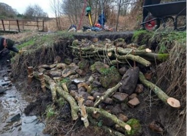
Funding from the NWG Bluespaces scheme has enabled Durham Wildlife Trust and partners to achieve 3.8 km of improvements to water environments within Milkwellburn Wood Nature Reserve, near Blackhall Mill, Gateshead.
Milkwellburn Wood is an 80 ha nature reserve owned by Durham Wildlife Trust. Long term PAWS restoration (Plantation on an Ancient Woodland Site) is being undertaken on the site to restore planted upon ancient woodland habitats and species. This project has allowed improvements to be delivered focusing on natural flood management on the Milkwell Burn and its tributaries flowing through the reserve, engaging both volunteers and contractors, alongside multiple access improvements to enhance the visitor experience across the reserve.
The access track between the reserve and the local village of Blackhall Mill and Blackhall Farm has experienced historic and recent flooding in spring 2023. A high flow bypass channel has been constructed by contractors at a culvert pinch point on the watercourse, and this together with leaky dam construction by volunteers on the woodland streams, has helped alleviate flood risk to the main access track and local communities downstream, providing a greater sense of security in high rainfall events. Dam construction has also resulted in more microhabitats across site, including deadwood and backed-up pools within the channels. Leaky dams are now included in the ongoing management of the site, to continue mitigation of extreme weather events and provide more varied habitat into the future.
Access improvements have also been delivered, including new interpretation signage, a review of waymarking across the site, and improvements to path surfaces by footpath flood prevention measures.
Bluespaces funding has been used in combination with a grant from Branch Out to support delivery of improvements to 1.1 km of water environment at Low Newton Junction Local Nature Reserve, Newton Hall, on the edge of Durham City in County Durham.
This is a well-used Local Nature Reserve owned by Durham County Council, providing access to blue and green space for the local community. Significant improvements have been achieved to access and recreational facilities as well as improved wetland habitats through invasive non-native species control, coppicing and scrub clearance.
Bluespaces funding has supported delivery of a multi-partner project to improve 1.2 km of water environment at a Woolsington Parish Ponds, in the upper Ouse Burn catchment, west of Newcastle.
Woolsington Parish Council (WPC) considers it a priority to future-proof The Parish Ponds as an important bluespace/greenspace area as the population of the area is expected to expand through housing development. It is expected and hoped that the site will become an important oasis for wildlife to thrive, as well as an essential recreational area for residents, contributing to their increased wellbeing.
This project has supported delivery of phase 2 of The Parish Ponds project, set out within the Woolsington Parish Council (WPC) Management Plan, and informed the development of the next phase supporting wider site ambitions. This work has enhanced the local site for both nature and people through footpath and habitat creation and improvements, together with offering community engagement activities for local residents.
Through this project initiated with NWG Bluespaces funding, Groundwork North East has worked with partners including Northumberland County Council, Ashington Town Council, Choppington Parish Council, Sandy Bay Caravan Park and Wansbeck Barrage Partnership to deliver access and recreation improvements to areas of the River Wansbeck in Northumberland, stretching from Sheepwash Weir to the mouth of the river Wansbeck, improving 4.7 km of water environment.
This project has built on the Revitalising our Estuaries programme, supported by the Green Recovery Challenge Fund, to expands work along the riparian corridor, focused on key recreational areas at Butlers Wood, Sheepwash Weir, Wansbeck Riverside Park, Wansbeck Barrage and sand dunes at Sandy Bay.
Funding to employ part time trainee Estuary Rangers and Supervisors has allowed improvements to be delivered to enhance this area and improve footpaths and access in the project area, ensuring that the water environment is attractive, open, and accessible for all. The removal of invasive plant species and encroaching scrub will allow native vegetation to recolonise the wider riparian corridor and protect priority sand dune habitat and. The proposed eel pass on the Wansbeck Barrage was not feasible to deliver in this project, but other wildlife and biodiversity improvements were identified including tree and wildflower planting and creation of lizard habitat.
Year 3
North Pennines Area of Outstanding Natural Beauty has improved 2.8 km of bluespaces around the Bowlees visitor centre in Teesdale.
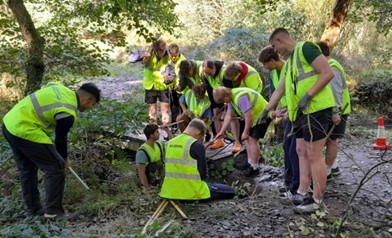
Regular litter picking, strategic tree planting and work in the purpose-built tree nursery have all contributed to increasing the biodiversity value of the area. Publication of walk leaflets, the development of a tramper trail network, and further access infrastructure improvements have been achieved through the project to benefit visitors. Volunteer activities, guided walks and educational activities based at Bowlees Visitor Centre with schools and youth groups have enabled a total of 484 people to gain a hands-on experience of the water environment, and to understand its management and pressures.
The results of work enabled by the Wild about Bowlees project will have long lasting effects which will continue to benefit the area for years to come. In addition, the project has highlighted the potential for the enhancement of the nature value and access opportunities elsewhere in the North Pennines AONB.
Northumberland Rivers Trust (NRT) has improved 2.5 km of bluespaces at Chugdon Dene, Ulgham Meadow Local Nature Reserve (LNR), and South Linton Farm in the River Lyne catchment.
The project has delivered great outcomes for the local area including new partnerships and future opportunities. 4200 native trees have been planted on 4.2 ha of former pasture at South Linton, including 600 alder planted along 2 km of riverbank. Engagement events and litter removal have created opportunities for volunteers and communities to engage with the River Lyne and local habitats. Access improvements at South Linton and Ulgham Meadow Local Nature Reserve (LNR) have supported previous work to improve access connectivity in the area.
NRT has worked with local landowners and identified opportunities for future work to further address diffuse pollution and improve biodiversity.
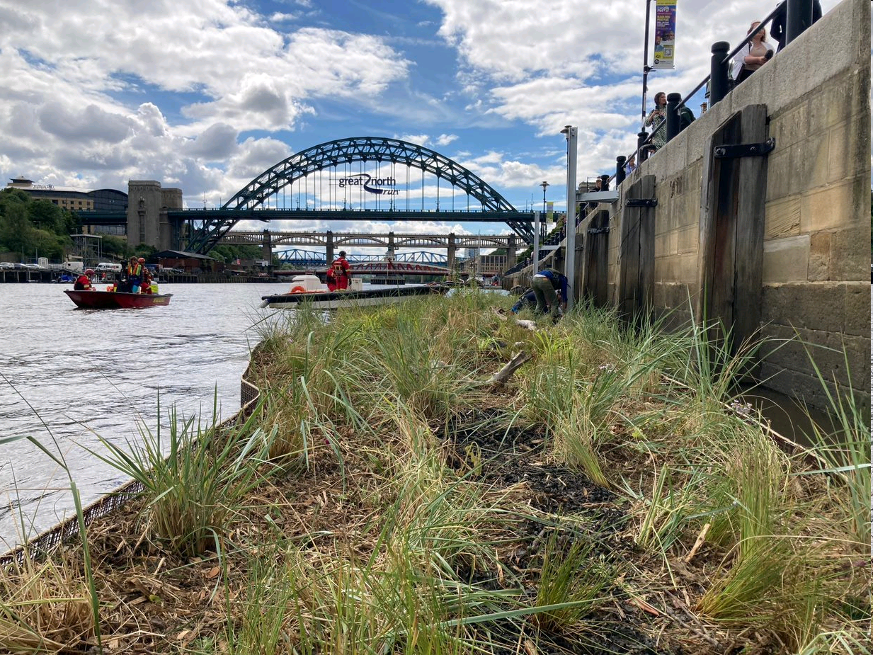
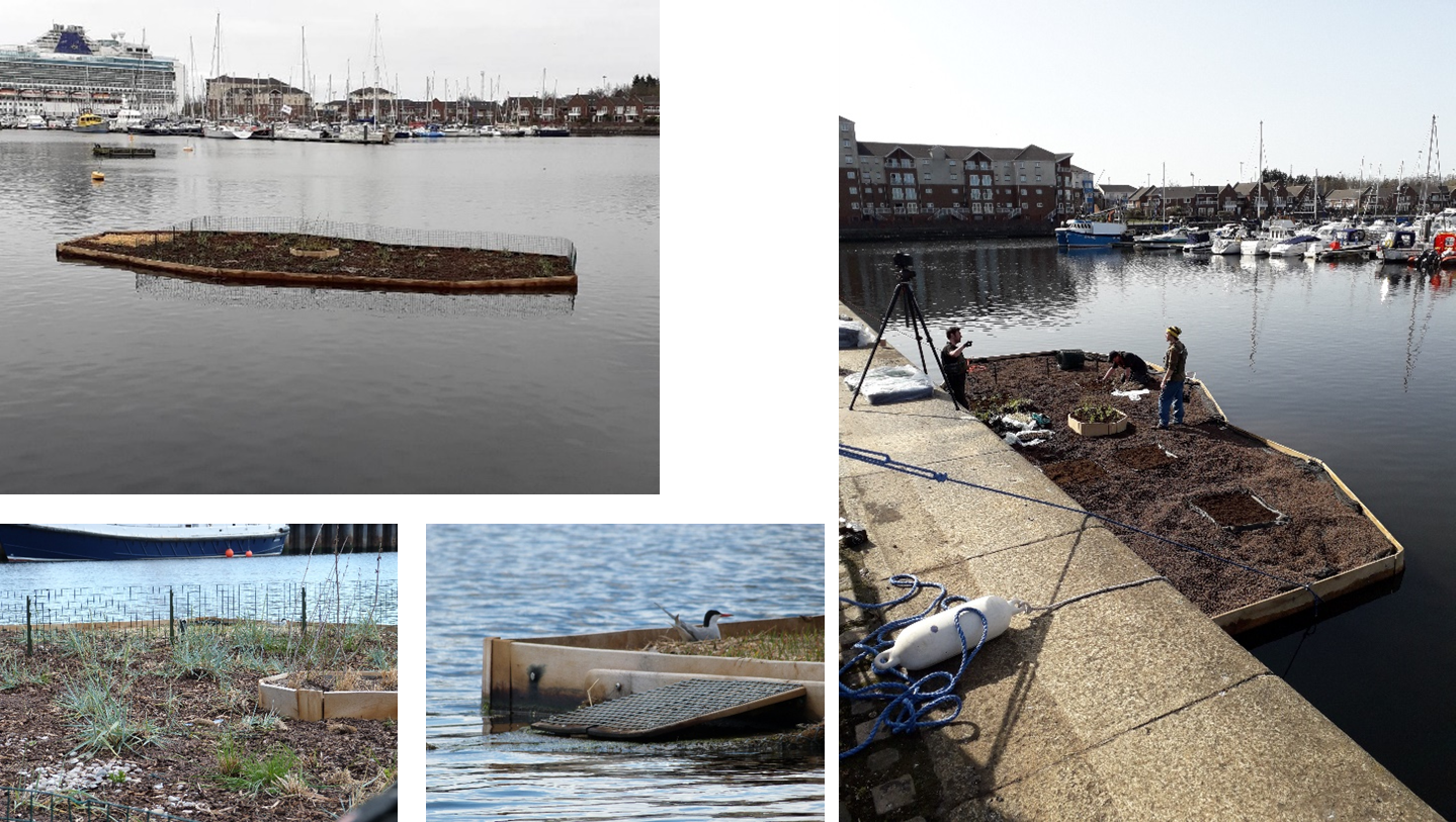
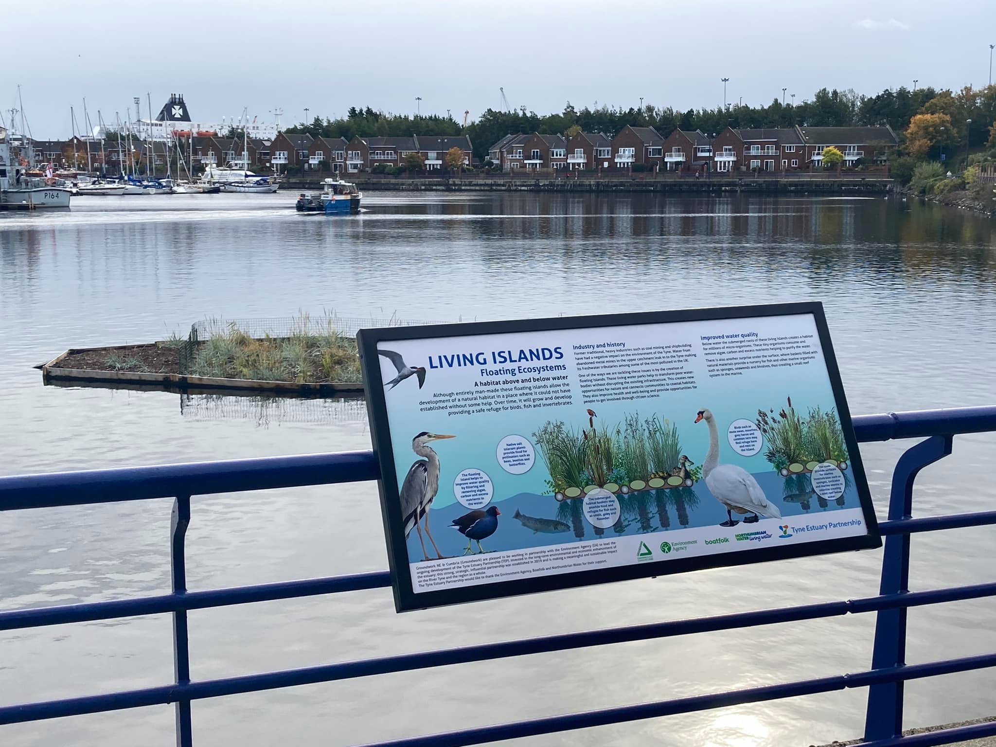
In partnership with Northumbrian Water’s Branch Out fund, Newcastle NE1 Ltd, Groundwork North East, Biomatrix Water and other partners have improved 0.8km of bluespace at Newcastle-upon-Tyne quayside.
The quayside covers a 1 km stretch of the Tyne and is heavily engineered with man-made walls and retaining structures along its length. The installation of a 1000 sq/ft floating tidal ecosystem, the first of its kind in the UK, has provided much-needed habitat in an area devoid of natural estuary edge. The floating ecosystem surface has been planted with a variety of native salt tolerant plants. Providing additional habitat for plants, birds and invertebrates. Further benefits have been seen below the water, where baskets filled with natural materials provide a nursery for fish and other marine organisms, creating a small reef system in the river. Visitor interpretation has been used to engage customers visiting the area, highlighting and explaining the purpose of the floating ecosystem.
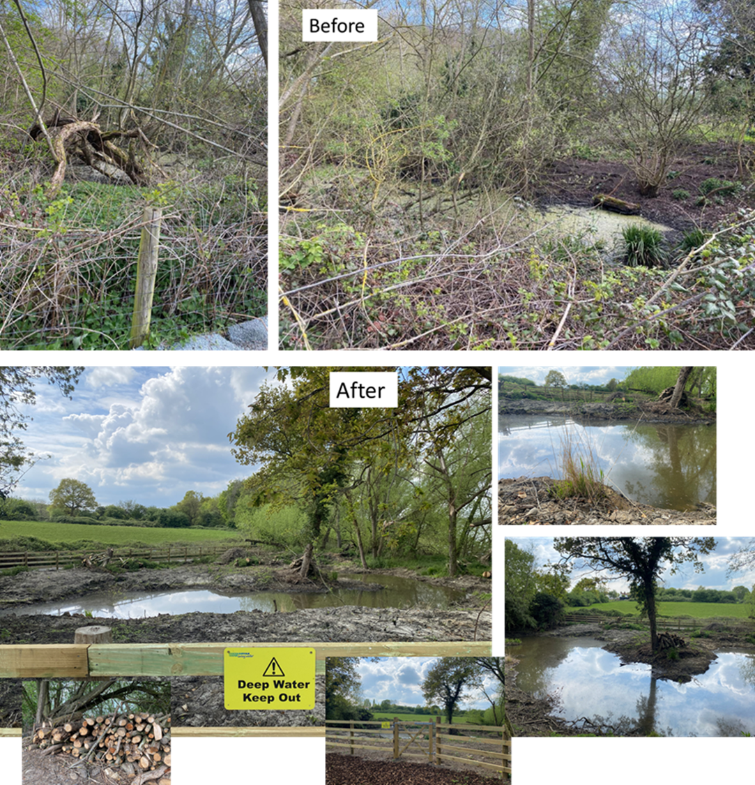
This project has worked to revitalise 2.4 km of bluespaces in Limekiln Gill and the coastal area, focusing on providing solutions to deter fly-tipping at the reserve, preventing pollutants from entering the stream, improving stream water quality. A variety of tasks have been delivered through the SeaScapes Landscape Partnership, working closely with Durham County Council’s Countryside Team. Activities include removing litter from the stream and beach, re-profiling an existing earth bund, renewing fencing, the creation of a small pond, and the planting of appropriate wetland species. A series of events and community engagement activities have taken place through the year.
A new pond/wetland area was created in the dene using a mini digger to excavate and reprofile the area in January 2023. Reeds (Phragmites australis) from a nearby wetland clearance have been excavated and replanted in the dene. A Series of ‘leaky dams’ have been installed using old fencing materials.
Litter picks and engagement of new volunteers has ensured locals become stewards of the area and regularly get involved in community groups, as well as being committed to regularly collecting rubbish from the stream, road and beach. Volunteers are linked to DCC’s Clean and Green Team and report fly-tipping incidents.
This project has delivered improvements to 4.3km of bluespace at Holywell Dene in Northumberland.
Holywell Dene has been made more accessible to for the local community and other visitors, and habitat improvements have been undertaken. Support provided through this project has enabled the local Friends of Holywell Dene (FoHD) volunteer group to undertake improvements, and ensures they have the resources they need to continue to deliver access and habitat management across the site into the future.
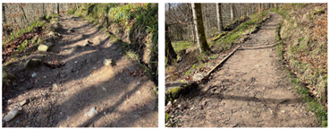
Gravel path resurfacing, new fencing, and step building has been undertaken to enhance, retain, and maintain safe access for the public across the project area. Three sets of steps have been constructed on steep and muddy sections of the Dene to improve access for site users. Control of Himalayan Balsam has been undertaken throughout the site and in upstream source areas.
Tree removal and vegetation management has been undertaken, facilitated by the purchase of a chainsaw for the FoHD group. This, and training of an additional operator for this, will support continued woodland maintenance and clearing of fallen trees from footpaths and the burn.
Additionally, a new parking area has been created at Holywell Pumping Station by NWG to support volunteer work party access to the dene when it is required.
This project has improved 3 km of Bluespaces along the River Rom, a tributary of the River Thames. Through the creation of wetland habitat, in-channel improvements and breaching of the embankment, the River Rom has been reconnected to its floodplain, created a pollution buffer and enhanced the area for wildlife. Visitors can enjoy the natural space, view the new interpretation and take part in community events and work parties.
This partnership project has delivered wildlife enhancements through the construction of a Kingfisher bank, otter holt and a new green roofed wildlife viewing hide. Educational elements to the project include 'Discovery' boat trips, family quiz packs, new interpretation material within the Discovery Cente and themed trail panels around the reserve.
This collaborative partnership project has improved 3.1 km of bluespaces around Diss, Norfolk. Projects outputs include the planting of riparian trees at four sites along the River Waveney, installation of flow deflectors, fish mattresses and pre-planted coil rolls. The invasive plant floating pennywort has been controlled along 2.6 km of the river channel improving the water quality and conditions for native species. A major element of this project involved the Yellow Fish campaign which highlights awareness of pollution in rivers and promotes ways in which we can all help prevent and reduce pollution.
This community project around Eye focusses on the healing power of nature and connecting the community with areas of bluespaces to support health and wellbeing. In addition to the creation of new pathways, interpretation, seating and picnic areas, wildlife and biodiversity has been improved through the installation of owl and bat boxes, the planting of trees and the creation of a wildflower meadow. Water quality has been improved through the installation of flow deflectors and silt traps and will be monitored through community and school riverfly surveys.
The project at RSPB North Warren has resulted in the creation of wetland scrapes and grips to enhance the quantity and quality of wetland habitat. Creation of the additional areas and the installation of predator fencing will especially benefit breeding waders such as Lapwing and Common redshank. Visitors to the site will benefit from improved views over the wetland reserve and from new signage and waymarkers.
This project has improved a 2.2 ha community reserve and brought a once neglected area back into conservation management. Bird and bat boxes have been installed, encroaching scrub managed and a historic channel through reedbed habitat opened up. Lucky visitors can observe Kingfishers feeding from the new fully accessible boardwalk and viewing platform and read about the wildlife on the new interpretation board.
This project at RSPB Boyton Marshes has expanded the reserve and created new wetland habitat for wildlife and people to enjoy. In total the project will create 30 ha of new freshwater habitat on former arable land providing habitat for priority species such as Spoonbill, Lapwing, Black-tailed godwit and shining rams-horn snails.
Year 2
Greening the Marina has delivered improvements to 0.4 km of bluespaces at Royal Quays Marina in North Shields.
Improvements include the installation of a 50m2 floating ecosystem, anchored in place and planted with native salt tolerant plants. This greenery softens an otherwise hard urban environment and provides additional habitat for plants, birds and invertebrates. There is also a surprise under the water where baskets filled with natural materials provide a nursery for fish and other marine organisms such as sponges, seaweeds, and bivalves to become established, creating a small reef system in the marina. New interpretation has been installed relaying information to visitors and helping to engage people with the environment.
This project has helped revitalise the Royal Quays Marina on Tyneside through a range of improvements to benefit people, wildlife and the environment. The work has helped transform a barren, man-made harbour to a more sustainable ecosystem where native wildlife can flourish.
Some highlights for this project are detailed here.
This bluespaces project was carried out in partnership with Northumbrian Water’s Branch Out fund, Groundwork North East, and the Tyne Estuary Partnership.
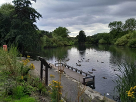
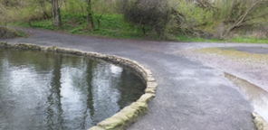
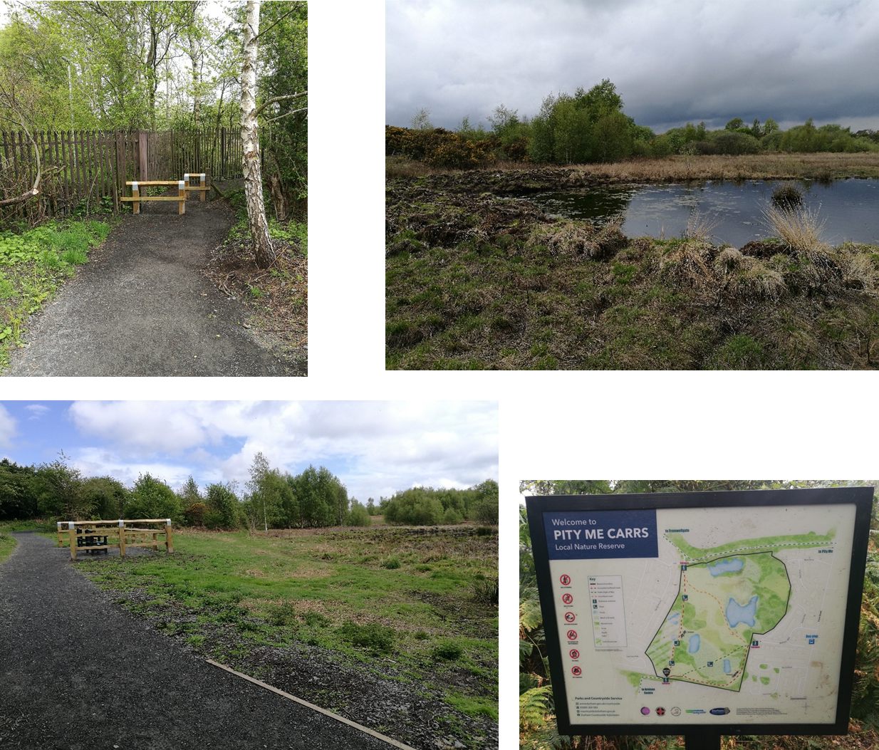
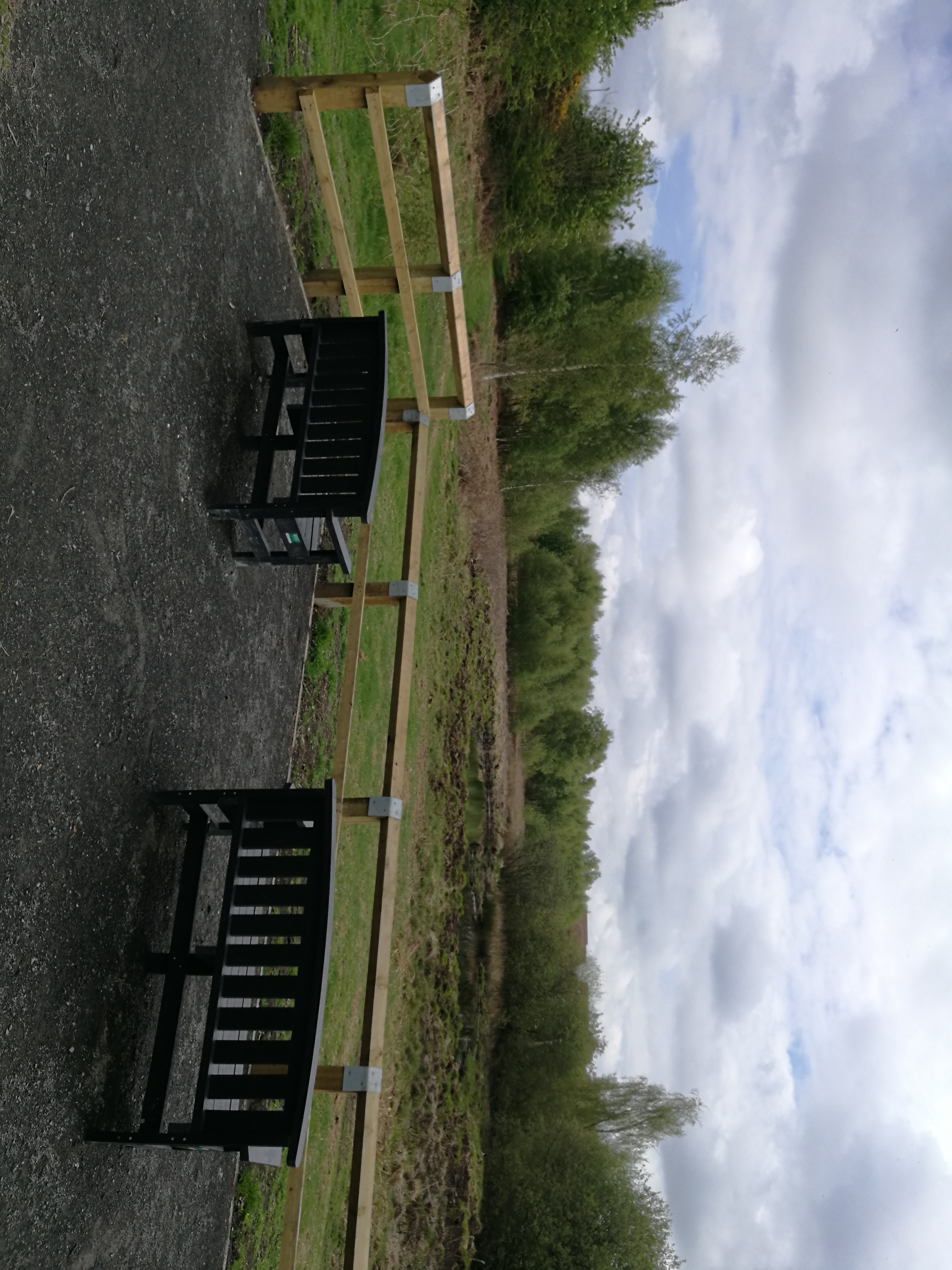
Improvements have been delivered to 1.1 km of bluespaces at Carrs Nature Reserve in Pity Me, Durham.
This project has improved public access and wildlife and biodiversity. The project has created a new 650m accessible path around the nature reserve, new viewing platforms with space for mobility scooters and wheelchairs, and benches provided for visitors. New interpretation boards with maps have been installed within the site.
Habitat improvements have been delivered to benefit all species at the site, including the protected Great Crested Newt, and these improvements will allow visitors to view more wildlife without having to access more sensitive parts of the nature reserve. Work undertaken includes creation of new pond habitat and new wildlife areas using cut tree waste.
This bluespaces project was carried out in partnership with Northumbrian Water’s Branch Out fund and Durham County Council.
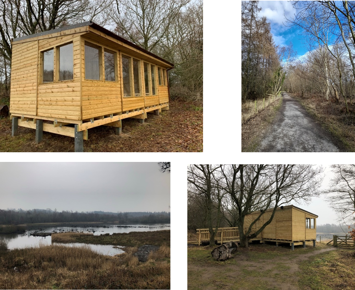
This project at Low Barns Nature Reserve in County Durham has improved 2.1km of bluespaces. Work undertaken includes footpath and signage upgrades to a fully accessible route on the site and the construction of a new education and engagement hub called ‘The Den’. This overlooks Marston Lake which has also benefited from habitat and biodiversity improvements, including desilting areas of the lake and its channels to maintain the habitat for freshwater species and protect the island breeding habitat used by wading birds.
Throughout the project, Durham Wildlife Trust has delivered a programme of events to help people connect with nature, learn more about wildlife, and enjoy the water environment at Low Barns. By improving the habitat on-site and having improved facilities with better information and access, DWT hopes to sustain high numbers of visitors and encourage greater participation in wildlife-related activities.
Northumberland Wildlife Trust’s Catch My Drift project has improved 4.8 km of bluespaces. This work is part of a wider three-year project (2020-23) at the 185-hectare East Chevington Nature Reserve in Northumberland, improving biodiversity and reconnecting people with nature.
Through the project 12 hectares of wildflower meadow and innovative ‘reed islands’ have been created, and existing reedbeds have been enhanced. Woodland management has created glades and rides, whilst the planting of bluebell and wild garlic bulbs will help increase the diversity of woodland flora, and shrub species such as Dog Rose and Hazel will provide a diverse food source within the enhanced woodland areas. Improvements to 3 bird hides and their access routes are due to completed by the end of 2022 to give everyone an opportunity to experience nature.
During the project, Northumberland Wildlife Trust has delivered a programme of events and activities to help engage people with nature and learn more about wildlife.
This project has focused on improving 5.8 km of bluespaces at Derwent Reservoir and Waterside Park and has been delivered in partnership with Durham Wildlife Trust and volunteers. Improvements have taken place between the Pow Hill and Millshield car parks and picnic areas, which act as hubs for visitors to the site.
This project has enhanced access and recreational facilities and biodiversity between these points of interest by creating and improving wildlife habitats, delivering improvements to the multi-user waterside path with additional seating, and by installing new information boards along the trail, to give customers an opportunity to engage and learn about the natural environments of the site.
Work as part of the Wilder Coast project has improved 1 km of bluespaces at Coatham Marsh Nature Reserve. This project, delivered by Tees Valley Wildlife Trust in 2021/22, has included the removal and replacement of a dilapidated boardwalk with earthworks providing a new raised path surface which takes visitors directly past enhanced open water habitat. An additional 200m of footpath in the reserve has also been re-surfaced, and a new timber bridge has facilitated access for visitors to enjoy the enhanced wetland area.
In October 2021 contractors, TVWT staff and volunteers worked to improve 0.3 ha of silted reed swamp and ditches, re-balancing the extent of reed swamp and open water habitat in this area, creating more marginal habitat for ducks and wading birds and toads.
9.3 km of bluespaces along the Tees coastline and associated coastal streams between Redcar and Saltburn have been improved by Tees Valley Wildlife Trust through the Wilder Coast Project in 2021/22.
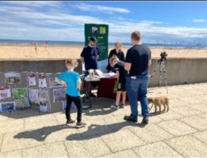
A new focus has been brought to the coastal environment through the employment of a designated Wilder Coast Project Officer, working to harness the public’s love for the coast into activity to address a number of issues. Project officer activity has included work to support the protection of internationally important coastal birds and their feeding and nesting habitats, engaging with customers and communities to promote positive environmental behaviours, and helping to manage plastic waste and litter through volunteering, events, and social media campaigns.
This work has been supported by a core group of volunteers, and further habitat work and access improvements at two coastal nature reserves in the area, Coatham Marsh Site of Special Scientific Interest (SSSI) and Saltburn Gill SSSI.
This is the first year of a multi-year project, which will deliver lasting impact across this often-overlooked area of the North East coast.
1.5 km of bluespaces at the Hanningfield Reservoir close to the fishing lodge and café has been improved in 2021/22.
Hanningfield Reservoir is a Site of Special Scientific Interest (SSSI) and includes a large reservoir and nature reserve managed by Essex Wildlife Trust. The reservoir is the only ESW site offering fishing, sailing and a café. Improvements to this site include footpath resurfacing, creation of a waterside picnic area, and the re-opening of a woodland walk path which links to a re-surfaced carpark and a newly enhanced pond. The land surrounding the pond has been seeded with three types of wildflower and grassland mixes and visitors can enjoy views of the pond from another new picnic area which has been surfaced with bark.
The project has provided substantial ecological habitat enhancements through wildlife and biodiversity improvements including numerous bird nesting and bat roost boxes. These will be checked by a suitably qualified ecologist and visitors invited to participate in these survey events.
A pole-mounted barn owl box has been installed in the new area of conservation-managed grassland, which has been specifically designed for reptiles, pollinators, and owls. The box is visible from the fishing lodge and new interpretation will be sited along the additional grass footpath.
2.2km of bluespaces at the River Roding in East London bordering Wanstead Park has been improved through this restoration project.
Thames21 has been working with partners to develop and implement freshwater habitat improvements on the River Roding. The two main aims of the project were to carry out habitat improvement works within the river and to improve access through Wanstead Park, allowing members of the public to better engage with the water environment.
The project has delivered in-channel and marginal habitat restoration to enhance ecological diversity and connectivity within a heavily modified river, and has also focused on ‘hinging’ small marginal trees into the river to diversify the flow pattern, provide areas of refuge for aquatic plants and to improve fish spawning habitat.
The project team worked with the local community and volunteers and carried out a number of work parties and volunteer sessions, which has helped improve access to the river, as well as directly contributing towards habitat improvements.
Thames Chase, Thames 21, The Land Trust, Thurrock Council and ESW have worked together to deliver improvements to 0.6 km of bluespaces at Davy Down in Thurrock, Essex.
This project has delivered ecological enhancements and floodplain restoration at this popular site along the Mardyke River. The partnership project has also raised levels of engagement helping to increase people’s appreciation of the natural, geological, archaeological and built heritage of the area.
Ecological improvements include an increase in the extent, quality, and connectivity of freshwater habitat through the creation of wetland scrapes, ponds and a backwater. In total, 840 m2 of floodplain has been excavated to create a mosaic of water bodies, which vary in depth and surface area to offer a variety of habitats. A new surfaced pathway linking the site to nearby South Ockendon has been created, and existing path upgrades have been completed.
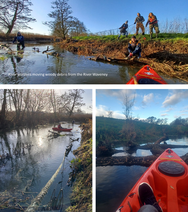
The River Waveney Trust, NWG and other partners have improved 6.8 km of bluespaces along the River Waveney. The project has helped enhance the in-river habitat of the River Waveney and improved biodiversity and access for customers.
A new project officer has been working with landowners, volunteers, and the community to identify areas of the river in need of improvement. They have also delivered a series of community training and volunteer sessions assisting in rebuilding and establishing positive relationships between landowners and river users as well as delivering training courses.
Over 20 volunteers have been fully trained as River Wardens and they regularly carry out surveys including using a canoe-over survey app. Where obstacles within the river have been identified, they have then been either removed or left in-situ as natural woody material to provide habitat for fish and to diversify the watercourse.
Year 1
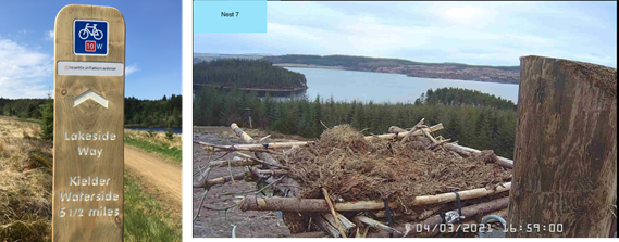
Improvements to 12km of Lakeside Way, a multi-use track around Kielder Water in Northumberland.
The stretch between Kielder Waterside and Tower Knowe has been enhanced by improved signage and interpretation, a dedicated Ranger role for the area to support the local red squirrel population, and a new base for Kielder Osprey Watch activities.
This work was carried out in partnership with the Kielder Water and Forest Park Development Trust, Northumberland Wildlife Trust, Red Squirrels Northern England, Northumbrian Water’s Branch Out fund and Forestry England.
Click here for more information on this project!
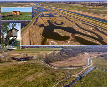
In Suffolk, where the company operates as Essex & Suffolk Water, it has supported huge investment into Carlton Marshes, a Suffolk Wildlife Trust site at Lowestoft.
Support was provided for the creation of a new 404ha wetland that has allowed customers access to 16km of paths and boardwalks to enjoy the wetland wildlife, with additional facilities provided for visitors including a new visitor centre and wild playscape.
This work was also in partnership with Natural England, Northumbrian Water’s Branch Out fund and local land managers.
Click here for more information on this project!
Customers visiting Essex & Suffolk Water’s Trinity Broads site in Norfolk can access viewing platforms via 0.6 km of accessible boardwalks and benefit from footpath repairs and improved car parking at Filby and Ormesby Little Broad.
People visiting Frenze Beck, near Diss, in Norfolk, can enjoy improvements to 1.5km of river via a 12ha county wildlife site, with a new footpath and boardwalks, disabled access, interpretation boards and benches to relax and enjoy the area.
This work will help visitors to better experience wildlife, supported by new wetland habitat and bird boxes. This was carried out in partnership with the River Waveney Trust and South Norfolk District Council.
Click here for more information on this project!